

Blindisalm

Description
The route starts in Maria Hilf. From there, you cycle along the Frattenweg on a gravel path beside the Schwarzach River into the upper Defereggental valley. You then follow the Defereggental state road toward the Staller Sattel pass, before turning off just before the high plateau and taking the farm road toward the Lappachalm. At the alpine hut itself, you can enjoy some excellent panoramic views, although the building is not currently in operation.
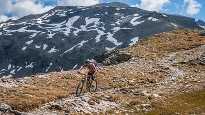
From the hut, the route leads along the so-called Zwei-Täler-Trail toward the Blindisalm on a rather interesting singletrack. The difficulty here is a maximum of S2, before you can stop for a break at the hut located at 1,896 meters above sea level. The route then continues back to the starting point via the old alpine trail, which has a maximum difficulty of S2.
In summary, this is a short ride that is particularly suitable for the summer months, as the Defereggental valley offers pleasant temperatures due to its high altitude.
Note: The route is located on Austrian territory and leads over routes that are not approved for mountain bikers. Riding this route on a mountain bike is the responsibility of each individual, in full awareness of the legal situation.
Map & GPX-Track
The map is only available to Ride subscribers.
The Ride-Subscription is available at ride-mtb.com/abo
.
Details of the tour
15 km
580 m
580 m
1430 above sea level
1937 above sea level
1 day
Maria Hilf
Maria Hilf
3732
well suited
More information
More tours nearby


User comments (0)

About the author: Martin Depauli
Note: This content has been automatically translated from German. Please report any incorrect translations.