

Bantiger Nordrunde

Description
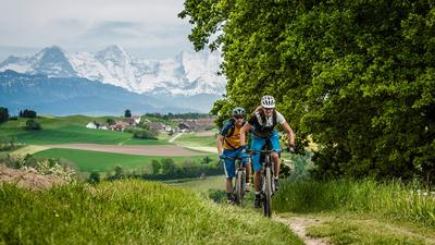
From Bern, you pass through the Enge district to Tiefenau and cross the Aare on the railroad bridge. From Worblaufen, head to the University of Applied Sciences for Agriculture, which is located just south of Zollikofen on the edge of the forest. In the Almitwald forest, you cross the highway at Forsthus and then climb up a winding forest road through the Grauholzwald forest. A short and less spectacular descent then leads to Brünnliacker and Hueb, where the actual ascent to Bantiger begins. A small road takes you to Vordere Jucke, then over Mülistei to the Bantiger transmitter antenna with its wonderful view of the city of Bern. The singletrail descent leads along the southern ridge path to Ferenberg and through the Buechholz to Stettlen. From here, you can either return directly to Bern via Ostermundigen or integrate the Ostermundigeberg into the tour with the descent to Gümligen. You ride through the Elfenau district back to the city center of Bern.
Map & GPX-Track
The map is only available to Ride subscribers.
The Ride-Subscription is available at ride-mtb.com/abo
.
Details of the tour
40 km
870 m
870 m
508 above sea level
940 above sea level
1 day
Bern
Bern
1152
well suited
More tours nearby


User comments (2)

About the author: Thomas Giger
Note: This content has been automatically translated from German. Please report any incorrect translations.
I rode the tour this morning. Basically a nice tour, but the GPX track needs a few updates.
Up to and including Bantiger Kulm everything is tiptop. It's also very pleasant that most of the ascents are in shady forest.
On the descent from Bantiger, however, the GPX track rides over a section that is explicitly closed to bikers.
The issue of steps and railings has already been mentioned - the passage through the upper part of the village of Stettlen is also difficult and not rideable with today's handlebar widths.
You can't ride the section at km 26.2 - the stairs have a railing and with the wide handlebars there is no Change