

Sette Colle Tour

Description
The first part of the tour rides uphill from Courmayeur (1200 meters above sea level) through the entire Val Veny up to the Col de la Seigne (2515 meters above sea level). The route rides on an asphalt road up to an altitude of 2000 meters above sea level. The surface then changes to gravel and becomes steep in the section up to the Rifugio Elisabetta. There is then a brief respite until the last section rides up to the pass on a singletrail. The trail is well developed and theoretically rideable - provided you have an e-bike or exceptional muscle power. With the Col de la Seigne on the French border, most of the ascent is done, but the Col des Chavannes (2592 meters above sea level) still has to be conquered. This section is on a trail that is easy to ride, and only at the very end are there a few sections of pushing to master. But: the highest point has still not been reached. Another single trail rides to Mont Fortin (2758 meters above sea level), still well maintained but so steep towards the end that even the e-mountain bikers can't make it any further.
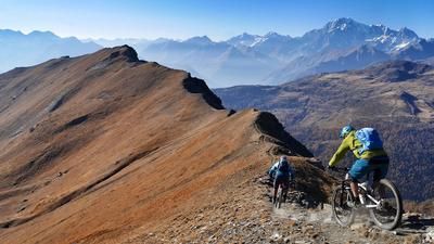
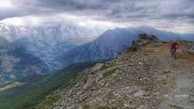
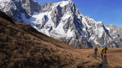
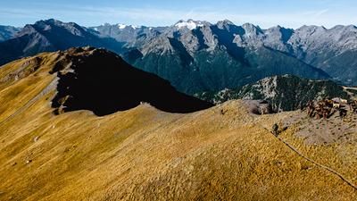
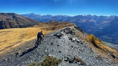
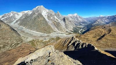
And once again, the highest point has not yet been reached. Mont Fortin is the starting point of the spectacular route along the mountain ridge through the high alpine landscape. The path was once created by soldiers and is still in pretty good condition today. The trail climbs uphill again and again, but is almost completely rideable on an e-bike (apart from the sharp serpentine bends) - provided you have a solid riding technique in alpine terrain. The route continues in this manner over the Col du Berrio Blanc and finally to the Col des Charmonts, the culmination point of the tour. Here the bike has to be shouldered for the last few meters. The exposed path through the high alpine terrain is strenuous and challenging, but the constant view of the Mont Blanc massif, the Val Vény and the Rutor glacier on the opposite side is priceless.
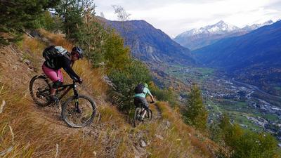
Now it's time for the long descent back to Courmayeur. The first few meters are not rideable, then the path becomes twisty and fun and you head down the steep meadow slope in serpentine mode. If you were expecting pure downhill fun, you've rejoiced a little too soon. Another short climb up to the Col de la Youlaz is necessary (about 50 meters in altitude), but then the drudgery is over. You shoot down to the Col d'Arp and then on a crisp trail through the wild mountain valley down to Alp Arp Damon. The following intermediate section on a gravel road is the downer of the tour, but a little later you head onto a super trail near Champtoret that rides down to the outskirts of Courmayeur.
Conclusion: A tour of extremes: extremely beautiful, extremely challenging, extremely varied, extremely strenuous. If you're looking for full mountain bike intensity, this is the route for you.
Note:
- It is possible to shuttle a good part of the ascent. The parking lot is located at an altitude of 1730 meters above sea level, access by car or the shuttle bus from Aosta Valley Freeride is easily possible.
- The name of the tour comes from the seven passes you pass: Col de la Seigne, Col des Chavannes, Col du Baracon, Col du Berrio Blanc, Col des Charmonts, Col de la Youlaz, Col d'Arp
Map & GPX-Track
The map is only available to Ride subscribers.
The Ride-Subscription is available at ride-mtb.com/abo
.
Details of the tour
39 km
1960 m
1960 m
1174 above sea level
2860 above sea level
1 day
Courmayeur
Courmayeur
2084
limited
More information
More tours nearby











User comments (0)

About the author: Thomas Giger
Note: This content has been automatically translated from German. Please report any incorrect translations.