

Vermoispitze – Trumsberg

Description
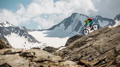
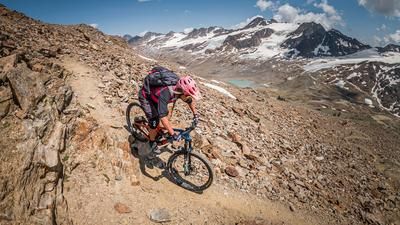
The route starts in the village of Latsch in the Vinschgau Valley. From here, you can take the cable car to St. Martin (1740 meters above sea level) or tackle the uphill via Kastelbell and the asphalt road under your own steam. From St. Martin, the route winds relatively steeply up to the so-called Rossböden. From this point, you take the 9er path and carry your bike steadily uphill. Step by step, you gain altitude and the views become ever more spectacular. A view of the Ortler group and the Martell Valley opposite opens up, giving you a glimpse of the eternal ice and the almost 4,000-metre summit. From the so-called Ochsenbühel, you briefly reach a plateau before climbing steeply up to the summit at almost 2950 meters above sea level. The 360-degree panorama on the Vermoispitze is unique. With good visibility, it is enchanting and makes you forget the exertions of the ascent.
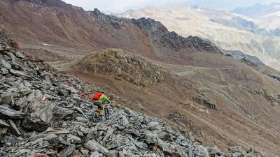
The downhill is at its most difficult right from the start. On S4, you head downhill towards the Schäferhütte. Full concentration and bike control are required here in order to complete the 8-person trail. From the Schäferhütte, the difficulty decreases and the route descends on S2 to S3 to Trumsberg (1433 meters above sea level). At Trumsberg, take the connecting trail to Mairhof as far as the start of the Tchillitrail and follow this via the Annenbergerböden back to Latsch. This descent should not be underestimated, although the difficulty is only S1 and S2, in places S3, there are still almost 1000 Elevation loss to be mastered.
Note: From Trumsberg, you can ride down to Latsch on the challenging 8-person trail.
Map & GPX-Track
The map is only available to Ride subscribers.
The Ride-Subscription is available at ride-mtb.com/abo
.
Details of the tour
17 km
1205 m
2315 m
625 above sea level
2823 above sea level
1 day
Latsch
Latsch
2306
not suitable
More information
More tours nearby









User comments (1)

About the author: Martin Depauli
Note: This content has been automatically translated from German. Please report any incorrect translations.
A dream (gate) tour :-)
The route to the Vermoispitze is definitely worthwhile, but you don't necessarily have to take your bike with you. Regardless of whether you choose this variant or the variant with the way back/way back (9er to St. Martin), the upper part can be ridden by very good riding technicians, but even these will clear half the slope. That doesn't have to be the case.
From the Alpl Sankt Martin you carry the 9er completely up, riding is not possible, pushing not much more. That means 3-4 hours of bike carrying.
The descent via the 8er to Trumsberg only rewards the effort to a limited extent. The upper part as already described, from the Schäferhütte then more rideable and technically not so difficult, but so narrow and with smaller trial interludes that you have to keep your head together. If only because it's easy to get your pedals stuck on the side of the road.
The last third from Schäferhütte to Trumser Alm is also quite steep and ruts on the path are actually unavoidable. The 8er down to the bottom is then very fun if you still have enough energy for fun :-)
Suggested variation - up to the Trumser Alm by bike (i.e. Kastelbell, Trumsberg, Trumser Alm up) and from there on foot to the summit. From the Trumser Alm, return as described here and enjoy the 8er to the full.