

Meidpass

Description
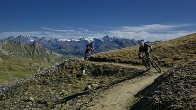
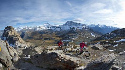
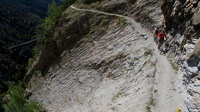
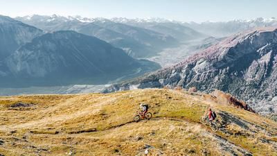
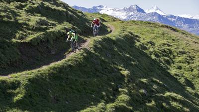
The tour ideally starts in Oberems. A small gondola lift takes you from Turtmann to the small village at the entrance to the Turtmann Valley. The first part of the ascent leads along the pleasantly steep little road through the Turtmann Valley until you branch off to the right onto the alpine road to the Meide-Alp. This section is already a little steeper, and after the alp you have to push on for 400 meters. However, the path is well maintained and the walk is easy. Once you reach the almost 2,800-metre-high Meidpass, phase two of the tour begins: the descent to Sierre. The single trail is technical at first, then becomes increasingly flowy and leads to Chandolin. A short counter-climb is necessary here to reach the world-class route to Sierre. This begins over the western Gorwetschgrat ridge and leads through the steep terrain to the highway exit at Pfynwald. The cycle path then takes you to Sierre railroad station.
Map & GPX-Track
The map is only available to Ride subscribers.
The Ride-Subscription is available at ride-mtb.com/abo
.
Details of the tour
39 km
1615 m
2410 m
1 day
Oberems
Siders
1496
limited
More information
No bike shops are registered for this region. Registration as a partner takes place here.
More tours nearby








User comments (13)

About the author: Thomas Giger
Note: This content has been automatically translated from German. Please report any incorrect translations.
I rode the tour on August 31, 2025. Ascent from Turtmann as described, first riding, then pushing. Great view from the pass. The first part of the descent was surprisingly easy to ride, only at the "crossing" did it become difficult. Not that it was particularly technical, there were just too many rocky deserts in the way, which didn't allow for any flow. It only got better from Lake Bella Tola onwards, before we hit a few super trails around Chandolin that I was already familiar with. However, the descent and the fence were new to me. And yes, this fence...I've read a lot about it...I have a few pictures in my head...but this fence beats everything. That alone made the tour worthwhile. It's unbelievable how much effort was put into it, even though you can get past this fence with minimal effort (removing the bike). Incidentally, there were definitely no bike bans on the track. The downhill was a little disappointing. Very washed out and rutted, with some height loss in places. I only had a bit more fun towards the end. So, as other commentators have already described, the Tour still has potential.
I ride a Scott Genius Ultimate, I'm usually in the head group uphill; downhill I'm always last, by a long way.
Tour done in reverse from St. Luc to Oberems-Turtmann.
From the St. Luc mountain station, a gravel road leads via Cabane Bella Tola to Lac Amina, i.e. with enough power, the first 500 m are rideable (and otherwise easy to push). After that, it's just under 300 m of rough, blocked trail and then zigzags up to the pass.
Down towards Turtmanntal, everything is also blocked and/or very roughly gravelled (not fun for us to ride because we always have to descend again after a few meters). From Meidu Stafil there was (finally) a wide gravel path down to the river, from where we rode for another 20 km on the shady/icy asphalt road into the valley.
Conclusion for both directions: If you like imposing stone fields, blocked paths and rough gravel challenges, this is the place for you.
We liked the views, flow and technical challenge much better on all the other Valais tours (e.g. Val d'Annivier tour #1664 or from Espace Weisshorn down to Zinal).
Very nice tour. From Meidstaffel you usually have to push. In the Meidsee area, the trail can be ridden again for a while. You only have to carry a few short sections, if at all. At Lake Arminasee we went straight down to 2341 (le Cret) and from there on the road to the Bella Tola hut. After the hut at 2192, be sure to follow the trail
according to the GPS and accept the short ascent. The direct route rides through rough terrain. The notorious wooden fence before the descent to Sierre can be passed without any problems. You ride down a marked trail running route Sierre-Zinal. At best, they had a hand in the funny fence. From Chandolin you pass a driving ban once beforehand. But somehow it doesn't look so official (?). Whoever installs the chairlift to the Illpass probably won't. But I could imagine that the part between 2274 and 2049 has numerous carrying passages. If you want, you can add the Augstbordpass from Moosalp. Very rewarding.
Tour ridden in reverse from Chandolin. The descent to Turtmann is fun and, apart from a short stretch of road (approx. 200m), consists entirely of singletrails. Perhaps the ascent from St. Luc makes more sense.
The tour can be ridden almost all the way with an e-mountain bike and the appropriate riding skills. The ascent over the trail from Alp Oberstafel requires very good e-mountainbike riding technique. Anyone looking for the possibilities of e-mountain biking and a technical challenge will have a lot of fun on the tour over the Meidpass.
Hello,
is the gap in the fence after Alp Ponchét still there, summer 2021?
The imposing "fence" is unchanged. However, with the front wheel removed, an e-MTB can also be pushed through the narrow passageway.
The ascent is very beautiful, despite having to carry a lot. The panorama is top! The first 200m descent is fun for technically experienced bikers, then there are a lot of ups and downs and a few short pushing passages to contend with until it's smooth sailing again. From the Rifugio Bellla Tola, however, it's great fun again. The barricade in the lower part of the descent can be bypassed.
The ascent is very beautiful, despite having to carry a lot. The panorama is top! The first 200m descent is fun for technically experienced bikers, then you have to put up with a lot of ups and downs and some short pushing passages until you can continue smoothly. From the Rifugio Bellla Tola, however, it is great fun. The barricade in the lower section can be bypassed.
Apparently there is a problem on the last section of the tour. After Alp Ponchet, the path is barricaded with a fence that bikes can't get over. An impressive pallisade blocks the onward route. We didn't notice any signs or indications anywhere, not even on the fence itself. With a thunderstorm breathing down our necks and thanks to a hole in this construction, we finally managed to continue... The trail is good. Looking back, the construction really seems to be aimed at bikers. At first we thought it was a game guard, cow fence or whatever... There are just no signs. Sad that there is such a thing, a simple sign at the top would certainly have persuaded us to take a different route.
Hi bastihapp1, thanks for your info. We are planning to ride the tour this weekend. Is it possible to drive around this path or do you have to go through the fence?
Best regards
The fence cannot be driven around or climbed over. The trick: simply remove the front wheel and push the bike through the fence without any problems.
We started the tour in Turtmann Dorf and climbed up to the Meide Alp at a pleasant gradient. The 400-metre elevation gain from the Alp is not steep, but it is long and drawn out. In the middle and at the end of the running section, the trail is briefly steep and you reach the next plateau and finally the pass.
From the pass to Chandolin, the trail is quite alpine, i.e. there is no real flow. There are barely 10 meters to ride at a stretch and then a 1-2 meter running passage follows. You should also allow enough time as the trail is long and has some steep climbs, and if I were to ride the tour again, I would take the alpine road to the Bella Tola hut as soon as possible.
From the hut, there is initially a flowing single trail, which then turns into a half-hour run through boulders. The trail is only rideable again from the water catchment to Chandolin. Next time, I would take the trail that rides below the 2100 meter altitude line from the Par di Mozes junction towards Chandolin.
From Chandolin, the ascent to Pramarin is easy to manage.
The descent to Sierre is the most beautiful of the whole tour. It should be noted that the trail to Sierre is already quite rutted, roughly comparable to the Brazil.
All in all, quite a long and beautiful tour, but the quality of the trails in the upper section cannot be compared with Brazil or Argentina.
If you don't have any problems pushing the bike or dismounting from time to time, you will experience a beautiful alpine tour.
Best regards Dani