

Amden-Rundtour

Description
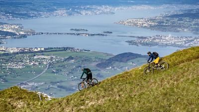
From Nesslau, you climb along a small road to the Vorderlaad area and then later to Hinterlaad. Finally, you ride through the forest on a gravel path to Hinter Höhi at the foot of the Mattstogg. The descent to Amden rides along a mix of small roads and single trails past Strichboden and Niederschlag to the center of the beautifully situated village. Now it's time for the second ascent, via Vorder Höhei back to Toggenburg. To do this, follow the little road which is also signposted as a mountain bike route (2 - Panorama Bike). At the top of the pass, however, keep left and soon follow the trail along the Dürrenbach stream to the Eggli group of houses. A little below is the village of Stein, from where you cycle back to Nesslau along the young Thur on trails and small roads.
Map & GPX-Track
The map is only available to Ride subscribers.
The Ride-Subscription is available at ride-mtb.com/abo
.
Details of the tour
30 km
1460 m
1460 m
1 day
Nesslau
Nesslau
1059
well suited
More information
No bike schools are registered for this region. Registration as a partner takes place here.
More tours nearby



User comments (5)

About the author: Thomas Giger
Note: This content has been automatically translated from German. Please report any incorrect translations.
2025... no map, no gps...
Apart from the lack of a Map or GPX; we rode the tour last Saturday. Unfortunately a little disappointing overall, as there was a lot of asphalt, very little natural road and almost no singletrack. From Stein, the 2.5 km on the main road up the valley were not particularly memorable either. From Wesen we took the car up to Amden, in my opinion anyone who does this by bike is crazy (steep, main road and lots of traffic). The scenery is definitely beautiful and there are a few cozy mountain restaurants as a small consolation. But how this tour made it into my book "Switzerland's most beautiful MTB day tours" remains a mystery to me.
The GPX file does not work. Too bad.
Today 15.12.2019 the Map and GPS-Track is still not available.
Unfortunately, the GPS track is empty and the Map has not been uploaded either