

Obruč Gipfel

Description
The tour starts near Dražice at the hikers' parking lot. From there, the trail initially rides steadily uphill to the north on gravel and asphalt in places. Further north, you follow a forest road, which later turns into a historic military road. This dates back to the time of the Vallo Alpino, the old Italian defensive wall, and leads up towards Štulac.
In the upper section, the ascent becomes increasingly rough and rugged - here you have to dismount and push your mountain bike. At the last junction on the forest road, the summit of Obruč is already signposted. Depending on your fitness level, you can now carry or push your bike up to 1376 meters above sea level.
Once you reach the top, you are treated to a first-class panorama: to the north, the view extends as far as the Alps, to the south across the Mediterranean and the Kvarner Bay with the islands of Cres, Krk and all the way down to Pag. A view that more than makes up for the sweaty ascent.
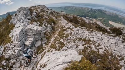
The descent that follows is also worthwhile. The trail sections vary between difficulty levels S1, S2 and S3. In the upper part in particular, there are tight hairpin bends on sharp-edged karst rock - clean riding technique is required here.
Further on, you follow the R.P.O. long-distance trail and ride down towards Vojak in a varied manner. This is where the transition to a gravel road takes place. Shortly afterwards, a selective trail section awaits, which leads to the former barracks of the Vallo Alpino. From here, you cross the hinterland in a cross-country style further south.
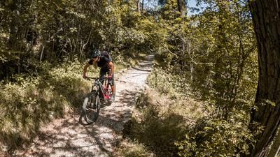
Several trail sections follow, technically demanding between S2 and S3, with the level of difficulty continuously decreasing towards the finish. The last few meters lead over a flowing cross-country route back to the starting point at the parking lot.
Note: The tour is well suited for e-mountainbikes, especially because of the long and sometimes challenging ascent. However, the summit section must be tackled on foot - whether you want to take on this section is up to you. An alternative start to the trail is possible around 100 meters below at the fork in the trail.
Map & GPX-Track
The map is only available to Ride subscribers.
The Ride-Subscription is available at ride-mtb.com/abo
.
Details of the tour
24 km
1020 m
1020 m
318 above sea level
1342 above sea level
Dražice
Dražice
3473
limited
More information
More tours nearby




User comments (0)

About the author: Martin Depauli
Note: This content has been automatically translated from German. Please report any incorrect translations.