

Kronenjoch

Description
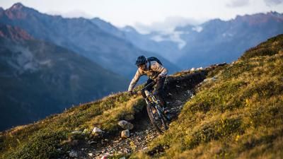
In Ischgl, the tour starts comfortably with the cable car. After two sections, the Flimjochbahn takes you up to 2750 meters above sea level. Now the trail fun begins at Ausser Viderjoch with the Schmuggler Trail, which rides quite flowy along the ridge over the Salaaserkopf to the short counter-climb at Zeblasjoch. A short descent is followed by another ascent that ends at the Fuorcla Val Gronda. The first longer descent begins here - now on Swiss soil - initially flowing, then more technically demanding to the Heidelberger Hütte. The mountain hut of the German Alpine Club offers a good opportunity for a short refreshment before the main ascent.
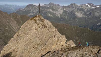
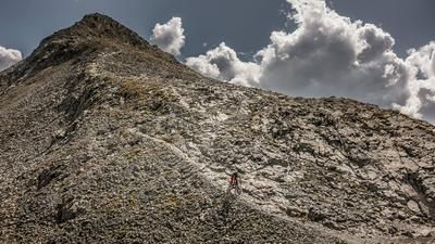
The 700 meters of altitude difference to the Kronenjoch and around 800 meters of altitude difference to the Breite Krone are only partially rideable. In the first section in particular, unrideable passages repeatedly force you to push, and the steeper sections afterwards are often unrideable even for experienced e-mountain bikers. After the Foppa Trida, the trail splits and rides to the right towards the Kronenjoch. Shortly before the high alpine crossing at 2975 meters, the route branches off to the left to Breite Krone. The ascent there is arduous, but the panoramic view is magnificent, although the descent is very challenging. Alternatively, you can leave the bikes at the bottom. If you leave this three-thousand-metre peak to the left, you can ride directly to the Kronenjoch and enjoy an impressive view before the descent begins again.
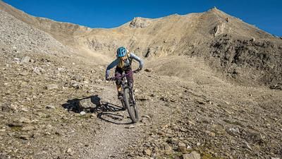
At first, a fine line leads down the gravel slope towards the Jamtalhütte. The descent is not overly difficult, but is narrow, steep and slow in places. Further down, it changes to rougher terrain. The transition from the barren, moon-like landscape to the alpine landscape is impressive. The last quarter before the Jamtalhütte is somewhat bumpy and characterized by alpine farming.
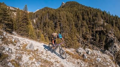
From the often well-frequented Jamtalhütte, the route descends for around one kilometer on the alpine road, after which it switches back to a singletrail. This makes up just over half of the section, but is not a leisurely roll-out. Again and again, technical passages demand your full attention before the trail fun ends a few kilometers before Galtür. The return trip to Ischgl is a leisurely ride on the cycle path along the wild and beautiful Trisanna river.
Note: The route is located on Austrian territory and leads over routes that are not approved for mountain bikers. Riding this route on a mountain bike is the responsibility of each individual, in full awareness of the legal situation.
Map & GPX-Track
The map is only available to Ride subscribers.
The Ride-Subscription is available at ride-mtb.com/abo
.
Details of the tour
45 km
1250 m
2650 m
1350 above sea level
3041 above sea level
1 day
Ischgl
Ischgl
3549
limited
More information
Pictures from the tour


More tours nearby





User comments (2)
About the author: Balz Weber
Note: This content has been automatically translated from German. Please report any incorrect translations.
Rode my e-bike yesterday! Starting from the Heidelberger Hütte, there’s plenty of rideable terrain for experienced climbers, with a maximum of 200 meters of elevation gain to push the bike uphill. From the Joch, we took a detour toward Grenzkopf and then on to the Futschöl Pass. It’s only worth it for motivated riders who want to tackle one more summit, since there are frequent sections where you have to push the bike. Otherwise, it’s a very nice ride!
We rode (or rather, pushed) this tour on July 24, 2026, on e-mountain bikes. It’s an epic, boundary-pushing experience and worth every drop of sweat—and there are plenty of those—until you reach 2,970 meters above sea level. There are many climbs to ride on an e-mountain bike, but it feels like you’re just pushing the bike the whole time…. With the push assist, it actually goes pretty well. The descent from the Kronenjoch is quite challenging, but with the right riding skills, 95 percent of it is rideable and very varied. Just make sure to allow plenty of time. We ran out of time, so we took the road down from the Jamal Hut all the way to Galtür.