

Gräben- und Winklmoosalm

Description
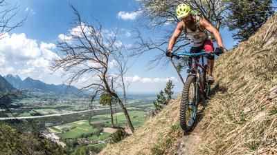
The tour starts at the bus station near the tourist information office in Reit im Winkl (696 meters above sea level). First follow the main road in the direction of the Masererpass until shortly after the start of the ascent the path branches off to the right up to the Gräbenalm (1001 meters above sea level). Follow this scenic but sometimes quite steep path past the Pankratius spring until you reach a forest road (you can also take a less strenuous forest road that branches off just below the top of the Maserer Pass). Now continue on a moderate ascent on a good path to the Gräbenalm. Cross the alpine pasture in a west-east direction to the alpine hut. This is the start of a trail that is a little rough in places, but still nice to ride with a few steps and hairpin bends (S3). A forest path is finally reached via a small bridge. Cross this and continue over steps on the trail, which becomes increasingly easier towards the end, through a small valley down into the Dreiseen area between Reit im Winkl and Ruhpolding. Follow the cycle path next to the main road for about one kilometer eastwards and turn right over a small footbridge down to the bathing spots at the crystal-clear Weitsee (744 meters above sea level). On hot days, it is definitely worth taking a break here for a swim. The Weitsee has drinking water quality and is one of the most beautiful mountain lakes in Bavaria.
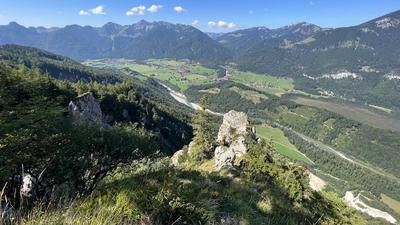
Continue on the south side of the lake on a well-signposted cycle path via the Dürrfeldkreuz (831 meters above sea level) on a former railroad line towards Seegatterl (771 meters above sea level). Cross the large ski area parking lot to reach the gravel ski run Winklmoosalm-Seegatterl. Via this, finally quite steeply up to the extensive and nationally known alpine pasture area (1160 meters above sea level), which is also part of Reit im Winkl. Continue northwards on a narrow asphalt road well signposted in the direction of Dürrnbachhorn (just below the valley station of the Dürrnbachhorn nostalgic chairlift, it is worth making a detour to the Traunsteiner Hütte). A little below the Dürrnbachalm (1335 meters above sea level), the second, easier trail of the tour begins on the left across a meadow. Via cart tracks, past Kohlstatt, you reach a forest road at 1065 meters above sea level. Follow this for around 200 meters and continue left along a beautiful trail back to Seegatterl. Then six kilometers on the beautiful cycle path along the Schwarzlofer back to the starting point in Reit im Winkl.Map & GPX-Track
The map is only available to Ride subscribers.
The Ride-Subscription is available at ride-mtb.com/abo
.
Details of the tour
33 km
990 m
990 m
668 above sea level
1308 above sea level
1 day
Reit im Winkl
Reit im Winkl
2997
More information
More tours nearby






User comments (0)
Note: This content has been automatically translated from German. Please report any incorrect translations.