

Hochegg – Walleralm

Description
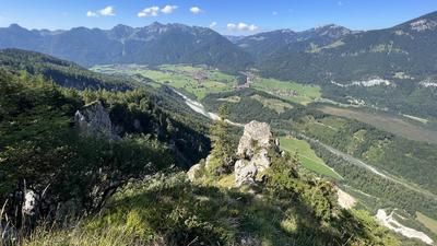
Start in Kufstein, right on the Austrian-German border. From here, the route follows the forest road up a pleasant medium to moderate gradient towards the Aschenbrennerhaus. The first few kilometers already offer impressive panoramic views of Kufstein, the Inn and the surrounding Inntal mountains. After a short crossing at the Brentenjochalm, you cross a wooded area and finally reach the Kaindlhütte. This is where the rideable section ends - from now on it's all about pushing and carrying. The trail continues to the Hochegg summit at almost 1500 meters above sea level, where a breathtaking panoramic view awaits you.
The subsequent descent towards Walleralm is on a varied trail with difficulty S2, occasionally also S3, depending on dryness and soil conditions. Typical for the Northern Limestone Alps, limestone, loose gravel and some technical key sections dominate here. This is followed by a final ascent to Kreuzbichl, the final summit of the tour. The view of the Inn Valley and the surrounding mountains is once again a real highlight. The main descent follows - also at S2 to S3 level, with increasing difficulty in the wooded area after the forest road crossing. S4 sections are also to be expected here, which require a solid hairpin technique. Otherwise, individual sections will have to be pushed off. The Rechausteig trail finally leads to the small hamlet of Rechau, where another trail section awaits - similarly challenging and with great views. The route continues to the Gaisgraben waterfall, which is worth a short detour. A final counter-climb takes you to the Köllenberg before you roll back to the starting point on relaxed trail and meadow paths.
Note: The descent via the Eibergstraße (B173) would theoretically be possible, but is not recommended due to the heavy long-distance and heavy traffic.
Note: The route is located on Austrian territory and leads over routes that are not approved for mountain bikers. Riding this route on a mountain bike is the responsibility of each individual, in full awareness of the legal situation.
Map & GPX-Track
The map is only available to Ride subscribers.
The Ride-Subscription is available at ride-mtb.com/abo
.
Details of the tour
21 km
1070 m
1070 m
490 above sea level
1440 above sea level
Kufstein
Kufstein
3429
limited
More tours nearby












User comments (1)

About the author: Martin Depauli
Note: This content has been automatically translated from German. Please report any incorrect translations.
A really nice and laid-back loop in the Kufstein area. Once you cross the forest road, though, it gets seriously tough. Anyone still riding here is definitely a rare breed of mountain biker. The Rechausteig is still a real challenge, but at least it’s doable for ambitious riders. Please describe the routes in a bit more detail. Thanks for your work!