

Monte di Ragogna

Description
The tour starts in San Pietro at the Pinzano Bridge, which crosses the Tagliamento. In this area, the river is strongly constricted, creating an impressive natural spectacle in the Italian Pre-Alps. The route initially leads steadily uphill on asphalt through wooded areas before reaching the first trail section after just a few meters in altitude.
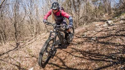
An interesting and mostly smooth mountain trail leads down to San Giacomo via Erde Direttissima. This section is rated S2 difficulty, but can reach S3 in places if the ground is damp. The route then continues to Muris and via a further ascent on asphalt to the western section of Monte di Ragogna. This is followed by another descent with similar characteristics (S2), which ends again near Muris.
The route then climbs again along the same route to the well-preserved and informatively labeled World War II positions. These relics are designed as an open-air museum and offer fascinating insights into the history of the region. A short detour leads to the highest point of the tour, Monte di Ragogna at 512 meters above sea level.
From here, there is a transfer before the descent begins along a historic mule track that rides towards the Tagliamento. The trail is technically rather easy (S1-S2), but there are safety fences in some places due to the risk of falling. Due to the vegetation, the trail can have slippery leaves, especially in fall and spring.
To finish, there is a final transfer to a final trail section that rides directly back to the starting point. In total, the tour covers around 750 meters in altitude, taking in the most prominent trails on Monte di Ragogna. Especially in the period of low vegetation in autumn or spring, there is a magnificent view over the Tagliamento and the foothills of the Alps.
Map & GPX-Track
The map is only available to Ride subscribers.
The Ride-Subscription is available at ride-mtb.com/abo
.
Details of the tour
16 km
650 m
650 m
177 above sea level
480 above sea level
San Pietro di Ragogna
San Pietro di Ragogna
3400
well suited
More information
More tours nearby




User comments (0)

About the author: Martin Depauli
Note: This content has been automatically translated from German. Please report any incorrect translations.