

Königsleitenspitze

Description
The tour begins in the idyllic village of Wald im Pinzgau and rides steadily uphill along the southern slopes. At the beginning, you follow the old Gerlos road, which already offers the first views of the impressive Krimml waterfalls and rides directly to Königsleiten. Here the route continues uphill through the chalet villages via the southern ramp towards Larmach Alm. Although the lift stations, which are empty in summer, can spoil the atmosphere somewhat, the increasingly better views at the top make up for it.
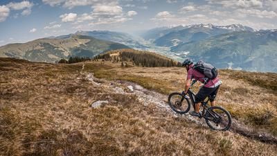
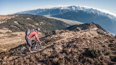
The last few meters to the Königsleitenspitze (2315 metres above sea level) have to be tackled by pushing or carrying. The highest point offers a magnificent panorama: the isolated location allows a spectacular view of the surrounding 3000-metre peaks of the Zillertal Alps and the main Alpine ridge.
The descent
The descent begins with a trail that rides down over the ridge towards the reservoir. Typical for the Kitzbühel Alps, slate rock and earthy passages dominate here. The trail is classified as difficulty S2 and offers an easy start. The reservoir, which offers an ideal opportunity to cool off in summer, marks the start of another ascent to the Müllachgeier. There you meet the 63 hiking trail, which continues down in the same manner.
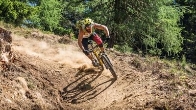
In the upper section, the trail remains at S2, but becomes more technically challenging in the lower section towards Müllachbach. Hairpin bends and key sections require good riding technique here. After this section, the trail continues along the Salzach in cross-country style before crossing it and entering another trail section (difficulty S1 to S3). This trail leads back to Königsleiten.
The way back
From Königsleiten, a transfer takes place via gravel paths with a counter-climb of around 200 vertical meters to the Gerlosplatte. Here you continue through the chalet villages to Hochkrimml and into the final downhill section. This elegantly designed mule track begins in the upper section with difficulty levels S1 to S2 and becomes more technically demanding in the lower section (S3). Above Krimml, the route runs in cross-country style through the Falkenstein area and finally leads back to the starting point in Wald im Pinzgau.
Conclusion: This tour combines challenging climbs, varied trail sections and a stunning mountain panorama. The varied route and the opportunity to cool off at the reservoir make it a highlight, especially in summer.
Note: The route is located on Austrian territory and leads over routes that are not approved for mountain bikers. Riding this route on a mountain bike is the responsibility of each individual, in full awareness of the legal situation.
Map & GPX-Track
The map is only available to Ride subscribers.
The Ride-Subscription is available at ride-mtb.com/abo
.
Details of the tour
42 km
1730 m
1730 m
870 above sea level
2278 above sea level
Wald im Pinzgau
Wald im Pinzgau
3365
well suited
More information
More tours nearby






User comments (0)

About the author: Martin Depauli
Note: This content has been automatically translated from German. Please report any incorrect translations.