

Manlitzkogel

Description
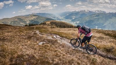
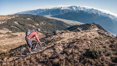
Start in Stuhlfelden or Pirtendorf. The route initially rides on asphalt, later on a well-maintained gravel road with a steady uphill gradient to the Manlitzalm. The ascent is homogeneous throughout, which makes it possible to gain altitude efficiently. When the Manlitzalm is open, it is the perfect place for a short break. From the hut, you leave the forest path and follow an old, partly dilapidated mule track. This is tackled by pushing or carrying as far as the Zehentner Stange - a historic crossing that was once used for alpine farming. From the saddle, the trail rides along an easy ridge hike with magnificent views to the summit of the Manlitzkogel at 2247 meters above sea level. Once at the top, an impressive 360° panorama awaits: the view extends from the Großglockner to the Großvenediger, the Dachstein massif and far into the Ahrntal valley in South Tyrol - a real highlight of the tour.
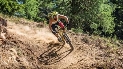
The descent starts right at the summit and offers everything an alpine trail has to offer: Sections at S1 to S2 alternate with challenging passages at S3 to S4, some of which are exposed. At this pace, you wind your way down the Rabenkopf to the summer gate. From here, the 10er/747er hiking trail rides smoothly downhill to the Viertalalm at around 1600 meters above sea level - technically mainly at S1 to S2 level. This is followed by a short, technically more demanding traverse where the bike has to be pushed or carried in places. The next trail section then begins - again on the 747/10er trail - steadily downhill towards Liebenberg. This section runs on S2 to S2+ and once again offers beautiful, technically varied passages. From Liebenberg, you roll back into the valley on asphalt, take a few more flowing trail sections and finally reach the starting point in Stuhlfelden/Pirtendorf via the Pinzgau cycle path.
Note: The route is located on Austrian territory and leads over routes that are not approved for mountain bikers. Riding this route on a mountain bike is the responsibility of each individual, in full awareness of the legal situation.
Map & GPX-Track
The map is only available to Ride subscribers.
The Ride-Subscription is available at ride-mtb.com/abo
.
Details of the tour
27 km
1400 m
1400 m
777 above sea level
2192 above sea level
1 day
Pirtendorf
Pirtendorf
3571
not suitable
More information
More tours nearby






User comments (0)

About the author: Martin Depauli
Note: This content has been automatically translated from German. Please report any incorrect translations.