

Zwölferkogel

Description
The tour starts in the small village of Hollersbach in Pinzgau. From here, you follow the Salzach in a relaxed westerly direction until you turn left in the Mühlbach area and tackle the uphill towards Karsee. The route initially leads over asphalt, later on gravel, along a classic forest road through idyllic larch and spruce forests. Beyond the vegetation line, an impressive view opens up to the north of the Kitzbühel Alps. At around 1600 meters above sea level, you reach the Karalm, where the uphill ends.
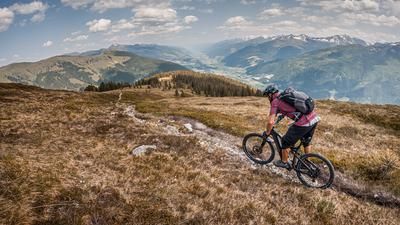
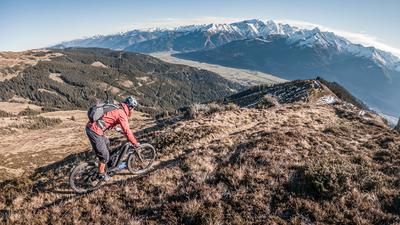
From here, pushing and carrying is the order of the day. There are still a few hundred meters of ascent to the Karsee (2100 meters above sea level). After the steep section, most of the carrying passage is behind you. From there, the route continues to the Zwölferkogel, a topographically outstanding summit that rewards you with a breathtaking mountain panorama. From the mighty 3000-metre peaks of the Hohe Tauern to the gentle Kitzbühel Alps - the view is incomparable.
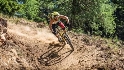
The descent begins on the 932 hiking trail and ranges from difficulty level S2 to S3 in the upper section. A hairpin bend technique is required to safely master the descent to the Karsee lake. The trail is also somewhat exposed in the ridge section. From the Karsee lake, the descent continues in a similar style: the trail remains challenging, but at times becomes more homogeneous and easier to ride.
Back at the Karalm, you return to the wooded zone. Especially in autumn, when the larch needles glow golden yellow, this route is a real feast for the eyes. At around 1300 meters above sea level, you switch to a narrower cart track, which is easy and fun to ride. This is followed by a few Elevation losses on a gravel road. After a crossing and a final trail section, you finally return to Hollersbach and the populated area.
Note: The route is located on Austrian territory and leads over routes that are not approved for mountain bikers. Riding this route on a mountain bike is the responsibility of each individual, in full awareness of the legal situation.
Map & GPX-Track
The map is only available to Ride subscribers.
The Ride-Subscription is available at ride-mtb.com/abo
.
Details of the tour
26 km
1520 m
1520 m
799 above sea level
2225 above sea level
Hollersbach
Hollersbach
3361
not suitable
More information
More tours nearby






User comments (0)

About the author: Martin Depauli
Note: This content has been automatically translated from German. Please report any incorrect translations.