

Maurerkogel

Description
The starting point of the tour is the village of Niedernsill near the Salzach. From here, the route leads on asphalt through meadows and hamlets towards Walchen. From Walchen, the official cycle route is initially on asphalt on a medium gradient and later on gravel towards Hochsonnbergalm. Especially in the upper section, just before the alpine pasture, there are fantastic views of the main Alpine ridge and the glaciated areas of the Kaprun Glacier. At the Hochsonnbergalm you can stop for a bite to eat or continue on. From the Alm, the bike is then pushed or carried up to the Maurerkogel. The Maurerkogel itself is relatively isolated and therefore offers a relatively good panorama in all directions.
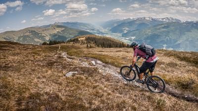
The descent then begins from the Maurerkogel. At difficulty level S2, the route leads along meadows, which can also be somewhat washed out depending on the weather conditions. You then cross the ridge to the west and reach the Rohrertörl. From the Rohrertörl, a panoramic trail of difficulty S1 continues to below the Niederer Gernkogel, briefly with some counter-climbs, and then a fairly easy trail of difficulty S1 and S2 continues along the entire ridge with some epic sections down to the starting point in Niedernsill. At around 900 meters above sea level, you join the asphalt road and roll down it. The tour is also doable on an e-mountainbike, but you have to skip the Maurerkogel and take the gravel road directly to Rohrertörl.
Note: The route is located on Austrian territory and leads over routes that are not approved for mountain bikers. Riding this route on a mountain bike is the responsibility of each individual, in full awareness of the legal situation.
Map & GPX-Track
The map is only available to Ride subscribers.
The Ride-Subscription is available at ride-mtb.com/abo
.
Details of the tour
28 km
1310 m
1310 m
762 above sea level
2041 above sea level
1 day
Niedernsill
Niedernsill
3117
limited
More information
More tours nearby






User comments (1)

About the author: Martin Depauli
Note: This content has been automatically translated from German. Please report any incorrect translations.
I tried the tour on May 6, but it was still a bit too early. I knew that the Maurerkogel wasn't possible. But even the great panoramic trail still had a few snow fields.
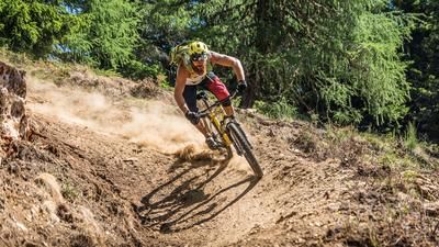
The downhill trail is flowy, but there are also a few tricky sections in the lower part.
A beautiful tour!