

Monte Casonet

Description
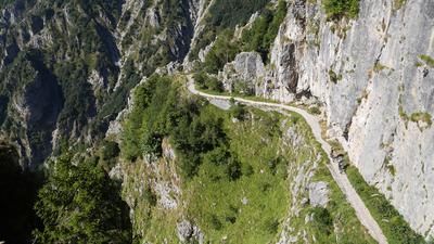
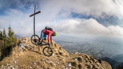
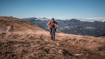
The route starts in the small village of Alano di Piave. Away from the hustle and bustle, you start on asphalt and pedal up the asphalt pass road to Monte Tomba in the north at a medium gradient of up to 10 percent. Past Monte Tomba, the route heads south and, in the summer months with particularly high temperatures, past Monte Palon and then onto the single trail with a tremendous panoramic view, the so-called Sentiero della Meatte. A structure that was built as infrastructure during the First World War now offers the perfect descent. Difficulty level S1 (S2 in places) is to be expected here with magnificent views down and some exposed sections. It rides to the Cason Val de Melin and then up and down on difficulty S1/S2 to the Col dell'Orso (1677 meters above sea level). This traverse is mostly rideable on an e-bike, but the uphills have to be pushed on an organic bike. Panoramic views are guaranteed at the summit due to the war positions and extend far and wide over the area.
The descent is then very varied. Between S1 and S2, the route leads to Cason del Sol, where some sections are broken off or have S3 difficulty. From Cason del Sol, you cross Monte Medata and come to the so-called Rommel Trail / CAI 849 - Camparona / Madal, a structure from the First World War, which runs along Monte Zoc. Difficulty levels S2 to S3 with some exposed sections are to be expected here. Once in Madal, the last section of the descent begins. Difficulty S2, occasionally S3, is again on the daily program here and is partly intensified by the loose stones. Thorns are to be expected, especially in summer at an altitude of 700 meters above sea level, as the vegetation is constantly growing due to the high temperatures. Finally, you return to the starting point of Alano di Piave.
Map & GPX-Track
The map is only available to Ride subscribers.
The Ride-Subscription is available at ride-mtb.com/abo
.
Details of the tour
32 km
1560 m
1560 m
289 above sea level
1621 above sea level
1 day
Alano di Piave
Alano di Piave
3138
well suited
More tours nearby






User comments (1)

About the author: Martin Depauli
Note: This content has been automatically translated from German. Please report any incorrect translations.
Well, the meadow part is mega, but I would classify the traverse to Col dell Orso and the descent there as very modest. The path uphill is hardly rideable as there is hardly any room to pedal. Except on the summit, which is possible. Now in June it is also often overgrown and there is no flow. The descent is full of thorns and the upper part after the summit slope is overgrown and not rideable...I gave myself the rest and went down the 153, which is at least rocky and rideable. Blockbuster legendary was the slog and the landscape...this part of the trail was not.