

Dutjer Alp

Description
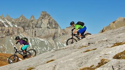
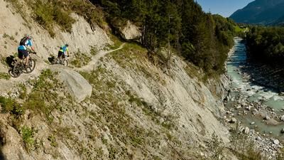
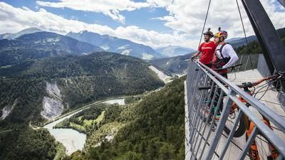
From Ilanz, you roll along a small road to Sevgein and then quickly gain altitude. You pass the village of Riein and finally reach the Alp da Riein. You have covered almost 1200 meters in altitude on the little road and have almost reached the highest point. You then reach the Dutjeralp with its fantastic views on a meadow path, which you can either ride or sometimes push, depending on your strength reserves. This extends over the Rhine Gorge into the Chur Rhine Valley, with the Prättigau Rätikon visible on the horizon. To the left, the view extends up the Surselva as far as the Tödi. The descent then follows the flowing and fun single trail down to Oberdutjen. Here you keep right, pass Alp Giera and reach the second part of the singletrail descent. Finally, you roll down the little road to Valendas to the banks of the Rhine. The trail along the banks of the Rhine begins right by the train station and leads from here to Castrisch and on to Ilanz.
Map & GPX-Track
The map is only available to Ride subscribers.
The Ride-Subscription is available at ride-mtb.com/abo
.
Details of the tour
30 km
1425 m
1425 m
1 day
Ilanz
Ilanz
1587
well suited
More information
No bike schools are registered for this region. Registration as a partner takes place here.
More tours nearby












User comments (6)

About the author: Thomas Giger
Note: This content has been automatically translated from German. Please report any incorrect translations.
Really great views and no other bikers or hikers on the way. The trail is quite demanding without an e-bike, up to the top it is really quite steep with light support and the tour is doable in 3 hours.
The descent is fun! The shortcut via the hiking signpost to Castrisch is indeed worthwhile, super easy trail.
Tour ridden on October 8, 2023:
.at the last farm (also parking lot) of Riein farm store with drinks and cake
.last 180Hm from Alp da Rein need "quite a bit of energy" without motor (road tracks on meadow, up to 16%)
.shortcut in LK to Valendas from point 1016 in the upper part no longer visible in the terrain, in the lower part cattle trail - a pity, would noticeably improve trail share
.last bend before Valendas can be shortened via hiking trail
We did the tour on 5.8.18 and found it not very rewarding. Uphill on asphalt road. Downhill half gravel road, half singletrack. These are more difficult than 3/6, which is the problem with the difficulty levels on this website: Runca trail 3/6, the more difficult Neverend trail also 3/6 and the much more difficult trail part of Dutjeralp also given as 3/6.
Fine tour, also very doable with the e-. The panorama is amazing, the trails would need the trail crew from Davos, but are still fun. The way back along the Rhine can be ridden despite the renovation of the bridge, just walk the first few meters.
All in all, a tour worth recommending. And if the 3 guys who found our gloves get in touch with me, I'd buy them another beer ;o)
It was fun. The ascent was hard on the legs. The descent was okay. The trails were quite rideable. The heavy rain washed out the trails and the cow dirt was gone. The bridge at Versam is always passable for cyclists and pedestrians.
Great views, quite ok for a half-day tour (4.30h)
You could also shorten the tour and ride straight to the Dutjer Alp at ~km10 where the actual singletrail begins. The whole tour over the alp is more of a cow pasture trail and seems to be very rarely used, but it still offers a great panorama!
In July 2017, the trail on the banks of the Rhine was closed due to renovation of the bridge (or we didn't realize it)