

Motta Palousa

Description
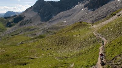
From Tiefencastel, first follow the signposted mountain bike route upstream along the Albula. At Surava, turn right and head up the long ascent to Motta Palousa. The gravel road winds its way up the steep forest flanks and becomes even steeper after Aclas. At Alp Ozur, the route turns into a singletrail and the last 240 meters of altitude have to be pushed to the transition at Motta Palousa. It is worth pushing on to the summit. The view from here of the Albula Valley, the Lenzerheide region and the Oberhalbstein behind you is simply fantastic. The descent then initially leads along the high trail to Spinatscha, where the world-class trail then leads down to the parking lot. Here you descend a short distance on the road, before soon turning right onto the next trail. This leads to just above Savognin. Instead of descending into the village, the trail follows the edge of the forest, past the meadow above Cunter, crosses the main road and finally ends at the Ziegelhetta ruins on the banks of the Gelgia. Now there is another ascent on the program. This leads via Salouf to Del, where the top descent to Tiefencastel begins just above the hamlet on the edge of the forest. The fun, flowing trail leads down to Mon and from there directly to Tiefencastel.
Map & GPX-Track
The map is only available to Ride subscribers.
The Ride-Subscription is available at ride-mtb.com/abo
.
Details of the tour
31 km
1620 m
1620 m
1 day
Tiefencastel
Tiefencastel
1536
well suited
More tours nearby












User comments (6)

About the author: Thomas Giger
Note: This content has been automatically translated from German. Please report any incorrect translations.
I rode the tour yesterday, 06.09.2023. Very steep and long ascent. From Alp Ozur difficult to recognize the trail. Red/white markings from time to time. But practically everything rideable with an e-bike. On the descent from point 2121, the upper trail is almost unrecognizable in nature. I then rode the lower trail, which was more clearly recognizable. When it branches off to the left up the fall line, it becomes very steep and you have to push. :( I wasn't sure whether this one continued upwards. In hindsight, I would have found the right trail. I then broke off and cycled the very steep alpine path to Cunter. Unfortunately I missed the best trails to Savognin. :( Trails from Savognin to Cunter in the forest are great :) In my opinion, the final descent from Mon is not always as flowy as described and is already very rutted. It also has a few blocked passages that an average biker can't ride. But all in all a cool final descent.
Top round.crisp ascent, and trails of all kinds.from Mon down to Tiefencastel the trail is already quite battered.highly recommended tour.👍🏻
Oh, then you put the 2 lanes in front of me. I was there yesterday too.
Cool tour. Flowy trails (the Mons-Tiefencastel section actually seems to be very busy).
Riding technique is more of a 2 overall, though. It's somehow not really challenging (maybe only if it were wet).
Recommended.
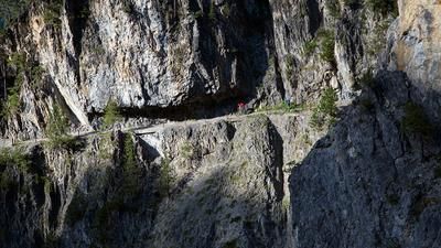
We rode the tour on 28.05.2022. Description correct, we find it worth mentioning that the trail to Spinatscha is exposed, very narrow and there is also a risk of falling. You should bring some patience and good nerves for this part. The forest trail to Spinatscha was the highlight of the tour for us, ranging from fun to technical and steep.
The tour is snow-free and all paths are in good condition.
We rode the tour last year as a late fall tour. Accordingly, the first few meters to Tiefencastel were very cold - especially for our fingers. However, we quickly warmed up on the ascent, which was easy to ride until the last few meters. The view from the summit is truly fantastic!
The subsequent high-level trail branches off several times, and we rode the route according to the GPX file well. But the other variants also lead to the same destination. Beware, this part has some short, quite biting climbs to offer!
From Spinatscha, a fun, albeit quite short downhill follows.
The section after the short gravel road intermezzo is not worth mentioning.
Beware, the turn-off to the path at the edge of the forest near Cunter was not too obvious, but we found it thanks to the GPS. But the path is worth it.
The final descent from Del is another real highlight!
Vacation Savognin