

Kellerbauer-Weg

Description
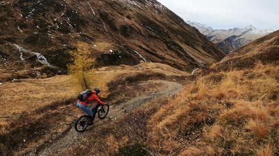
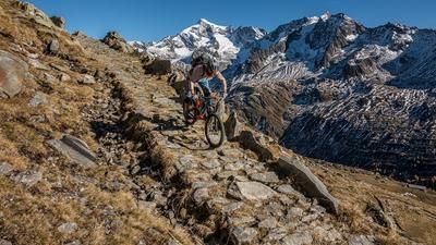
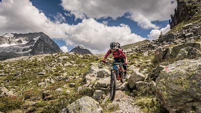
In Sand in Taufers, you first roll to the valley station of the gondola lift and ride the first 1000 meters up the mountain without breaking a sweat. The cable car ride makes sense, especially as the ascent ahead is hard enough. You make your way up the mountain on a steep gravel track, reach the saddle just below the chairlift station and continue up to the fork in the path just below the Speikboden summit. The main part of the ascent is done here. But those who rejoice too soon will be punished later by a cramp in their calves. For now, however, euphoria is the order of the day: the Kellerbauer trail, which has now been reached, leads super smoothly down to the Mühlwalder Jöchl, after which the route becomes trickier but still easy to ride. Again and again you are confronted with short climbs, and once you even have to push your bike through a short section of rock. Although the ups and downs are strenuous, the Kellerbauer trail, built in 1907, is fascinating due to its scenery with a direct view of the southern flanks of the Zillertal Alps: Hochfeiler, Grosser Möseler, Schwarzenstein, Grosser Löffler, all of which stand opposite each other in a row.
Once you reach the Wurmtaler Jöchl, the Kellerbauer trail is a thing of the past. This continues on the right to the Chemnitzer Hütte, while we take the descent into the Mühlwalder Tal on the left. The trail descends in alpine style to the Foreralm, then enters the forest and follows the signposted path towards Mühlwald. Initially, the path is quite tricky, but then becomes faster and smoother as the distance increases. In this way, it rides endlessly down to the valley floor, where you follow the gravel roads on the right bank of the river to Mühlwalder See. Due to a lack of trail or gravel alternatives, the following section rides along asphalt roads, at least always next to the main road (which is not very busy anyway). Shortly before the village of Mühlen at the end of the descent, you turn left again onto a trail that is not rideable at first due to the narrow hairpin bends, but ends after a few meters in the Mühlener Klamm, a small gorge with a singletrail that makes up for the long asphalt section. You now cycle back to Sand on the cycle path along the main road.
Map & GPX-Track
The map is only available to Ride subscribers.
The Ride-Subscription is available at ride-mtb.com/abo
.
Details of the tour
28 km
740 m
1770 m
850 above sea level
2433 above sea level
1 day
Sand in Taufers
Sand in Taufers
1980
limited
More information
More tours nearby










User comments (0)

About the author: Thomas Giger
Note: This content has been automatically translated from German. Please report any incorrect translations.