

Col du Granon

Description
The ascent from Briançon to the Col du Granon is quickly told: You roll along the road via Saint-Chaffrey to Chantemerle and then turn onto the pass road. A total of 1040 meters of altitude difference then accumulate up to the culmination point, where you can fortify yourself at the Buvette at the top and enjoy the fantastic panorama over the Ecrins massif.
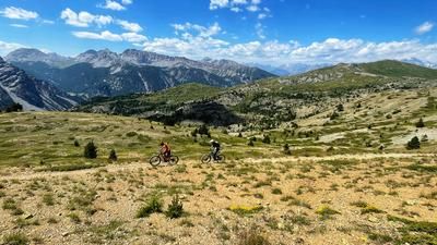
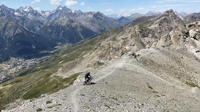
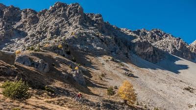
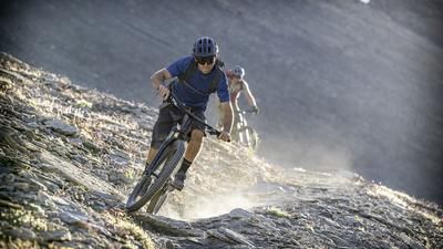
The return trip to Briançon is exclusively on single trails and starts right next to the parking lot at the top of the pass. A great, flowing path hugs the mountain flank and descends through the southern slopes into the wooded area. There are the odd hairpin bend here and there, but overall the trail belongs in the S1 class with a few S2 sections. This is the way to Briançon until you reach a gravel road at the settlement of Etieux. Climb up this road to the Croix de Toulouse high above Briançon. Here you have a great view of the small town steeped in history, but above all this is the start of the fantastic final descent. A somewhat slippery S1 path leads through the dry pine forest down to Fort de Sallettes and the uppermost houses of Briançon. As a final highlight, we recommend a detour to the picturesque and historic old town of Briançon - the ideal place to round off a great tour with a cool drink.
Map & GPX-Track
The map is only available to Ride subscribers.
The Ride-Subscription is available at ride-mtb.com/abo
.
Details of the tour
29 km
1260 m
1260 m
1327 above sea level
2417 above sea level
1 day
Briançon
Briançon
2943
well suited
More information
More tours nearby










User comments (4)

About the author: Thomas Giger
Note: This content has been automatically translated from German. Please report any incorrect translations.
A really beautiful run. In some spots, it’s best not to make any mistakes, or you’ll take a long fall. We also took the Descente de Bois de l’Ours at the end, just like one commenter mentioned earlier. It has a few very tight hairpin turns and a steep drop-off that’s probably reserved for experts. The rest of the run is a pleasure to ski.
Did this today. Parked in Chantemerle and set off from there. A leisurely climb, and starting at 10 a.m., there’s delicious espresso at the top! We also went up to the Col de l’Oule. An easy trail up and down. The trail down was a dream, and soon there was hardly anyone else on the path. A few exposed sections here and there. We didn’t go to the Croix de Toulouse after that, but took the trails back to the starting point.
We did the tour at the end of June 2026. A beautiful descent from the Col toward Briançon. Breathtaking trails. The descent from the Croix de la Toulouse isn’t as much fun (anymore). The “Descente Du Bois De L’Ours,” which starts descending before the Croix de la Toulouse, is nicer. However, there’s a very short, very steep, and technical section there.
The approach to the trail is very beautiful. As is often the case in the area, there are some more exposed sections from time to time, but all in all it is a technically moderate descent as described. In the last section from the Croix de la Toulouse, there were even a few hikers out and about in the fall. If you fancy less abyss and more technique, you can also take the turn-off to the sharp right in the undulating section after the col. It is flowy here at first, but there are also S3 sections later on, creating a good mix (a little slippery when wet). The section is clearly visible on trail forks. At the end, you virtually come out on the ascent road, but first have to briefly climb a hill that offers a final view of Briancon.
Both tours are worthwhile, the ascent to the col is quite relaxed. We also drove up via Fort Lenlon (cake bunker) once.
By the way, a must in Briancon: the Amorino ice cream parlor ;)