

Grand Aréa

Description
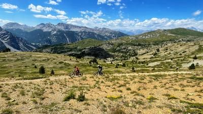
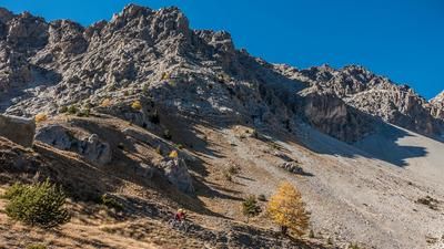
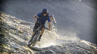
The start of the tour is almost trivial: you roll uphill on the road towards Col du Granon, but then turn left below the culmination point and roll the last stretch up to Col de Buffère on a gravel road. In this way, you circle the Grand Aréa on the south side and the view upwards does not suggest that the rocky mountain can be conquered by bike. But appearances are deceptive! From Buffère, you switch to a trail and climb up towards the summit. You reach a steep and rough section where you have to push your bike a few meters. But don't throw in the towel just yet! After just a few meters in altitude, the trail switches back to rideable mode and winds its way through rocky terrain for around 300 meters in altitude. Technically experienced e-mountain bikers and strong organic bikers reach the summit riding almost continuously, except for a few sections. This ascent is an extraordinary experience - as is the view across to the glaciated Ecrins massif.
The descent follows the ascent route to the Col de Buffère and is in the S2 range, spiced up with a few S3/S4 sections. You then switch to a gravel road to the Moulette stream. The singletrail a little further up is marked as an MTB route, but it's no fun and has lots of pushing sections and flow killers. After the stream, the trail climbs a few meters up to the ridge and the start of the great trail down to Le Monêtier. In S1 mode, you curve through the forest, never steep but it feels endless. In this way, you reach the picturesque village of Le Monêtier and then roll along country roads and finally along a water pipe path (Sentier du Canal Neuf - watch out in high season: lots of pedestrians!) back to Chantemerle.
Map & GPX-Track
The map is only available to Ride subscribers.
The Ride-Subscription is available at ride-mtb.com/abo
.
Details of the tour
39 km
1650 m
1650 m
1351 above sea level
2836 above sea level
1 day
Chantemerle
Chantemerle
2942
well suited
More information
More tours nearby









User comments (3)

About the author: Thomas Giger
Note: This content has been automatically translated from German. Please report any incorrect translations.
Did this today. An absolutely amazing ride! One of the most beautiful peaks, combined with one of the smoothest trails I've ever ridden in the Alps. And to top it off, the easy but super-fun trail down into the valley. Thanks for the ride!
The ascent on asphalt is a nice change, also that it is quite moderate up to the saddle afterwards. The ascent up to the summit was largely unrideable for us without a motor because it was simply too steep (we would describe ourselves more as fit organic bikers). Riding down was fine.
The ascent back up is a short, poisonous climb, then the descent as described is very easy with a few tight bends. The last section along the water pipe is very nice again.
We wanted to find out for ourselves whether you can actually reach such a summit on an e-bike!
And what an experience! The summit slope would be rideable up to a few meters, provided you have enough energy and battery. With a push aid, it's easy to get to the summit. Super panoramic view as far as Mont Blanc.
Unique descent directly from the summit past amazed hikers!
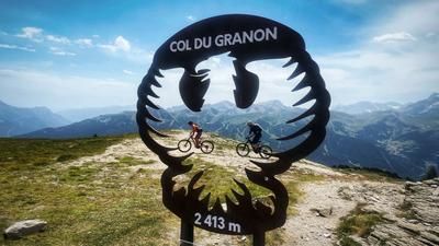
We then pedaled back to the pass road and up to Col Granon and chose the descent from Col Granon to Briancon, a trail pleasure like no other.
Route corresponds to the description