

Montgenèvre Trail Giro

Description
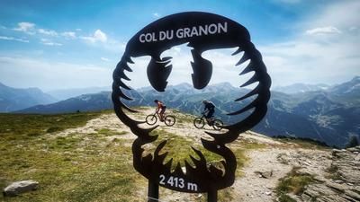
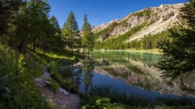
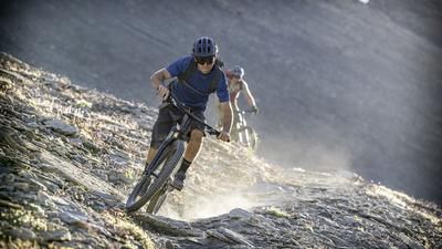
Start the day by taking the chairlift from Montgenèvre up to the Sommet des Anges. Here you have a great view over the entire Briançon region, but you can also enjoy it again later. For now, the focus is on the trails. To warm up, you whizz down a winding trail, climb a few meters up to the Col du Gondran and then take the super fun and flowing trail over to Lac Gignoux, also known as Lago di Sette Colori. Here there is a steep section on a gravel road up to Col Saurel, after which you start the trail highlight number 1 of the day. The path down to Claviere is a flow bomb! Flowy, varied, fast but always with phases where you have to keep your head together. All in all, an S1/S2 highlight.
Just before Claviere, keep left and climb past the golf course up to Montgenèvre. The Chalvet gondola lift is now on the agenda, which takes you to the wide panoramic trail high above the valley floor. This is the feeder to trail highlight number 2 of the day: the descent from Rocher Deseur down to the road to Montgenèvre. The S1 trail is a banger of a serpentine, all the bends are rollable, and in between the trail is super flowy and embedded in a dry and open pine forest.
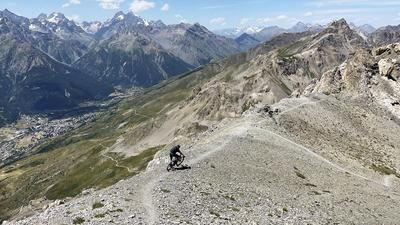
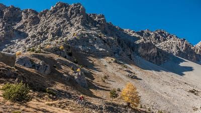
On the main road, you then roll a short distance up to the chairlift and ride a second time to Sommet des Anges. Now it's time for the descent on the southern side towards Briançon. You reach the ruins of La Cochette on a gravel road. This is where trail highlight number 3 of the day begins - the descent towards Briançon. At level S2 with individual S3 phases, it is somewhat more challenging and steeper than the trails so far, but a super fun ride. It seems to meander endlessly towards the valley floor until you turn onto a gravel road far below. If you organized a shuttle from Briançon up to Montgenèvre in the morning, you can now roll comfortably down to Briançon. Everyone else turns onto the gravel road and climbs the 400 meters back to Montgenèvre.
Note: The bus from Briançon to Montgenèvre transports bicycles on individual connections. However, these must be registered 36 hours in advance.
Map & GPX-Track
The map is only available to Ride subscribers.
The Ride-Subscription is available at ride-mtb.com/abo
.
Details of the tour
37 km
850 m
2340 m
1418 above sea level
2444 above sea level
1 day
Montgenèvre
Montgenèvre
2941
well suited
More information
More tours nearby










User comments (6)

About the author: Thomas Giger
Note: This content has been automatically translated from German. Please report any incorrect translations.
Please note: The Chalvet gondola will be closed in the summer of 2026 for maintenance work.
We skied down from Fort de L'Infernet at the end of June 2026. A beautiful run. Pure enjoyment!
We rode the tour in July 2025 at the ride camp in Briançon. A very beautiful and varied tour with lots of trails.
We rode the tour without the lift and motor, which is why we decided to do a loop. However, the ascent on the gravel road is very moderate, especially compared to other climbs in the area. We opted for the easy loop, the descent was as described, i.e. technically moderate but scenically beautiful (especially in the fall). However, I don't recommend the steep face at Lac, but there should be a slightly more moderate ascent slightly to the left of it, but we only saw this from the top. We then went back up to the end of the les Chalmettes lift, where bike park routes also start, which are quite nice.
The prerequisite for a Bahnentour is that the cable cars are in operation! This is not the case in September, neither on the Italian nor on the French side 😬We therefore put together the ascents ourselves and completed the tour, the first part to Claviere by biobike and rode the second stage a few days later by e-bike from and to Briancon, this trail is more challenging and steeper.
The landscape is unique and the trails are almost inexhaustible.
What a great tour combination! We parked in Montgenèvre and then went down towards Briançon and then did the small loop and finally the amazing loop over the Gondran. Absolutely recommendable!