

Tschaufer Nock

Description
The tour starts in Vilpian. From here, you have a choice: either take the cable car for a leisurely ride to the top and follow the route via Verschneid, or make the ascent under your own steam. If you opt for the more athletic option, the route follows the main road toward Rauhenbühel. You’ll then pedal on asphalt through numerous switchbacks with moderate to steep gradients toward Oberlegar and steadily uphill along Möltener Strasse. The sweeping views are already incredibly impressive here. Especially in spring and fall, when the vegetation clears the view, a wonderful sense of “Mediterranean lightness” emerges.
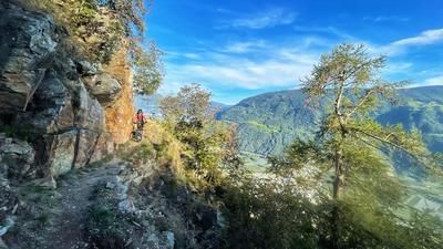
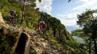
The ride continues to Verschneid and finally to Gasthof Tschaufen. The inn itself is idyllically nestled in the landscape and offers an impressive panorama to the south toward Penegal and Roen. After a short stretch on gravel, the trail branches off toward the Etschtal after just a few meters. The difficulty ranges between S1 and S2 on the single-track scale. However, caution is advised in wet conditions: the surface of cobblestones and stone slabs, combined with fallen leaves, should not be underestimated and requires the occasional skillful maneuver on the mountain bike.
Further along, you cross the Möltener Strasse again and use the next section—with similar difficulty, though slightly higher in places—to return to Vilpian. The abrupt change in landscape is remarkable: the lower you go, the more Mediterranean the surroundings become. It’s not uncommon to pass right by cacti and other southern flora in the lower section—a fitting finale to a varied tour.
Map & GPX-Track
The map is only available to Ride subscribers.
The Ride-Subscription is available at ride-mtb.com/abo
.
Details of the tour
21 km
1060 m
1060 m
247 above sea level
1299 above sea level
1 day
Vilpian
Vilpian
3669
well suited
More information
No bike shops are registered for this region. Registration as a partner takes place here.
More tours nearby

















User comments (0)

About the author: Martin Depauli
Note: This content has been automatically translated from German. Please report any incorrect translations.