

Monte Rinder Perk

Description
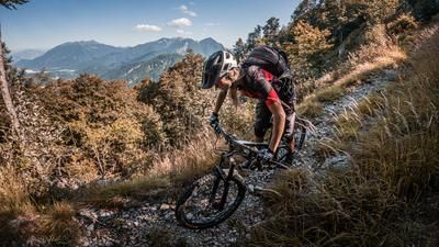
The tour begins at Lake Zahrer, also known as Lago di Sauris. From there, the route winds steadily uphill on asphalt toward Sauris di Sotto. Through its architecture, place names, and cultural characteristics, this trilingual village conveys a strong connection to North Tyrol or Bavaria rather than to Friuli. This German-speaking influence is characteristic of the region. The route continues on gravel, interrupted by a short descent, before the final, strenuous climb to Malga Pieltinis begins. From Malga Pieltinis, you cross the ridge on a mule trail directly to Monte Rinder Perk. At the highest point of the mountain bike tour, a wide plateau opens up with a breathtaking 360-degree panorama amidst an impressive natural landscape. Then the long descent begins. On singletrack trails rated S1 and occasionally S2, the route descends to the next uphill section. After a short transfer, you return to the reservoir and thus to the starting point via a trail of similar difficulty.
Map & GPX-Track
The map is only available to Ride subscribers.
The Ride-Subscription is available at ride-mtb.com/abo
.
Details of the tour
18 km
900 m
900 m
979 above sea level
1730 above sea level
1 day
Sauris di Sotto
Sauris di Sotto
3648
well suited
More tours nearby








User comments (0)

About the author: Martin Depauli
Note: This content has been automatically translated from German. Please report any incorrect translations.