

Poignon

Description
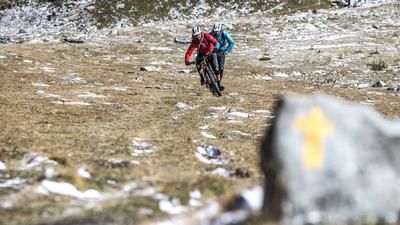
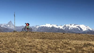
The Poignon tour usually starts in Villeuneuve a little up the valley from Aosta. Here you take the little road up to Champlong, leave the village behind you and change to a steep gravel road at the edge of the forest. This winds its way 550 meters up the mountain. And if you think you've made it to the top, you've overlooked the second small climb after a short descent. At the Petit Poignon forest clearing, the ascent is finally over and the single trail branches off to the left - a flow firework display! The trail is quite steep in places, but easy to ride throughout. It ends at the historic viaduct in Pondel. You then stay on the left side of the valley, climb a little further up to the small tunnel, and then the second part of the descent begins. An often dust-dry path leads through the steep terrain, a careful riding style is required here, and finally the descent ends at the bridge to Aymavilles. It's now a cat's meow back to Villeneuve, and it's not far to the center of Aosta either.
Map & GPX-Track
The map is only available to Ride subscribers.
The Ride-Subscription is available at ride-mtb.com/abo
.
Details of the tour
19 km
1050 m
1050 m
653 above sea level
1558 above sea level
1 day
Chavonne
Chavonne
1565
well suited
More information
More tours nearby















User comments (9)

About the author: Thomas Giger
Note: This content has been automatically translated from German. Please report any incorrect translations.
Great tour. Exactly as described.
If you still have the energy—or enough battery life—you can head back up and take a different trail down. 😉👌
Rewarding tour. Rather steep at the top, S2-S3. Then rather easier, but quite exposed in places.
Unfortunately a bit unkempt with lots of leaves and pine cones.
If every biker took 5 minutes per descent to clean up a bend and kick a few dozen pine cones off the trail, the necessary trail care would already be done.
We rode the tour 2 days ago. The ascent is strenuous but easily doable, took about 1.5 hours. In the first part of the descent there was still a lot of foliage and pine cones in the forest, which made the whole thing a bit slippery. After the tunnel, as described, the dry little path, which requires attention. After the short asphalt road, another fun trail down to the bottom. Highly recommended!
We rode the tour the day before yesterday. Super great tour...! Definitely do it...! Great ascent in the forest and awesome trail. Very dry but super rideable. Full of variety. Always stay focused. Wonderful views in between. Take enough time with you. It would be a shame if you couldn't enjoy the tour.
Ascent: The first 500 m on tar with a pleasant gradient. Then natural road, partly 18% steep, rideable.
Descent: Flowy, similar to a bobsleigh run, hairpin bends easy to ride, only the last part is partly downhill.
half day tour
Beautiful tour, perfect for a half-day.
The ascent is technically easy, but physically demanding. The 57' indicated in the GPS route is unrealistic. We certainly had 2 hours to the top.
Really good trail back to the valley - but anything but easy after rain, partly washed out. There are always technically demanding passages.
Despite only 19 km, it is better to plan enough time.
We started in Villeneuve on Wednesday, August 30. At the very top, there is a signposted lime tree to the right of the path. This is where the fireworks begin, a super trail, every bend has its own melody. After the tunnel, a short, tricky 3 bends. A real treat in the area!
We rode this trail today. The route is mostly as described. The GPS data has certainly been added to the map, it doesn't always match the ascent, but you can still find your way very well. In the ascent (villages) there are always fountains to be found, so that the need for fluids is always covered. A large part of the ascent is also in shady forest. The part of the descent that leads back up to the tunnel is too steep to ride, so you have to push. But all in all a great tour with brilliant downhill trails! Many thanks for the tip.